
Smjrifle Interactive Maps (Google Maps + Leaflet)
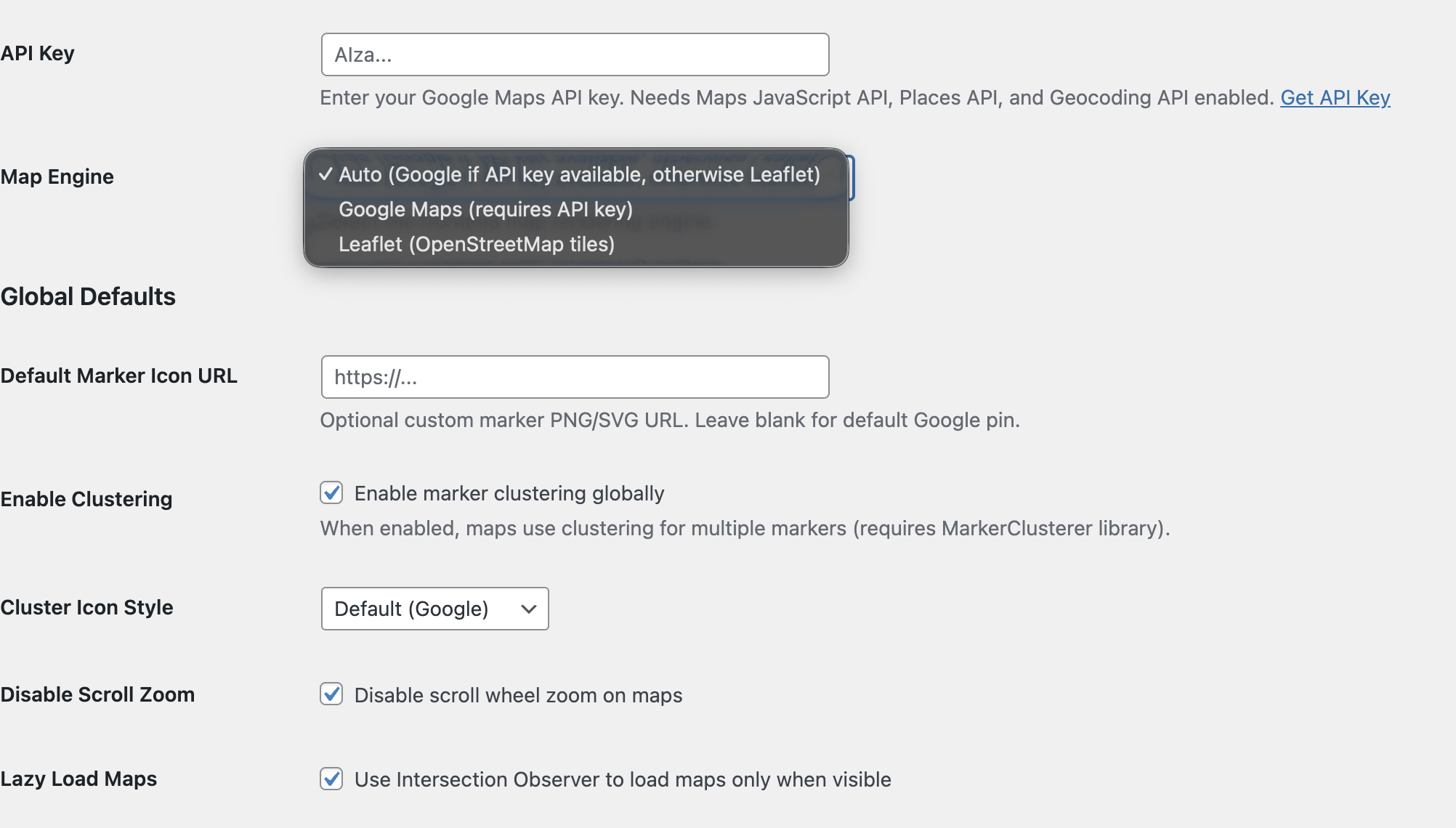
Developed a fully custom WordPress mapping plugin that brings flexible, production-ready map functionality directly into the WordPress ecosystem. The plugin supports both Google Maps and Leaflet (OpenStreetMap) engines, allowing seamless fallback and ensuring maps remain functional even without API dependencies.
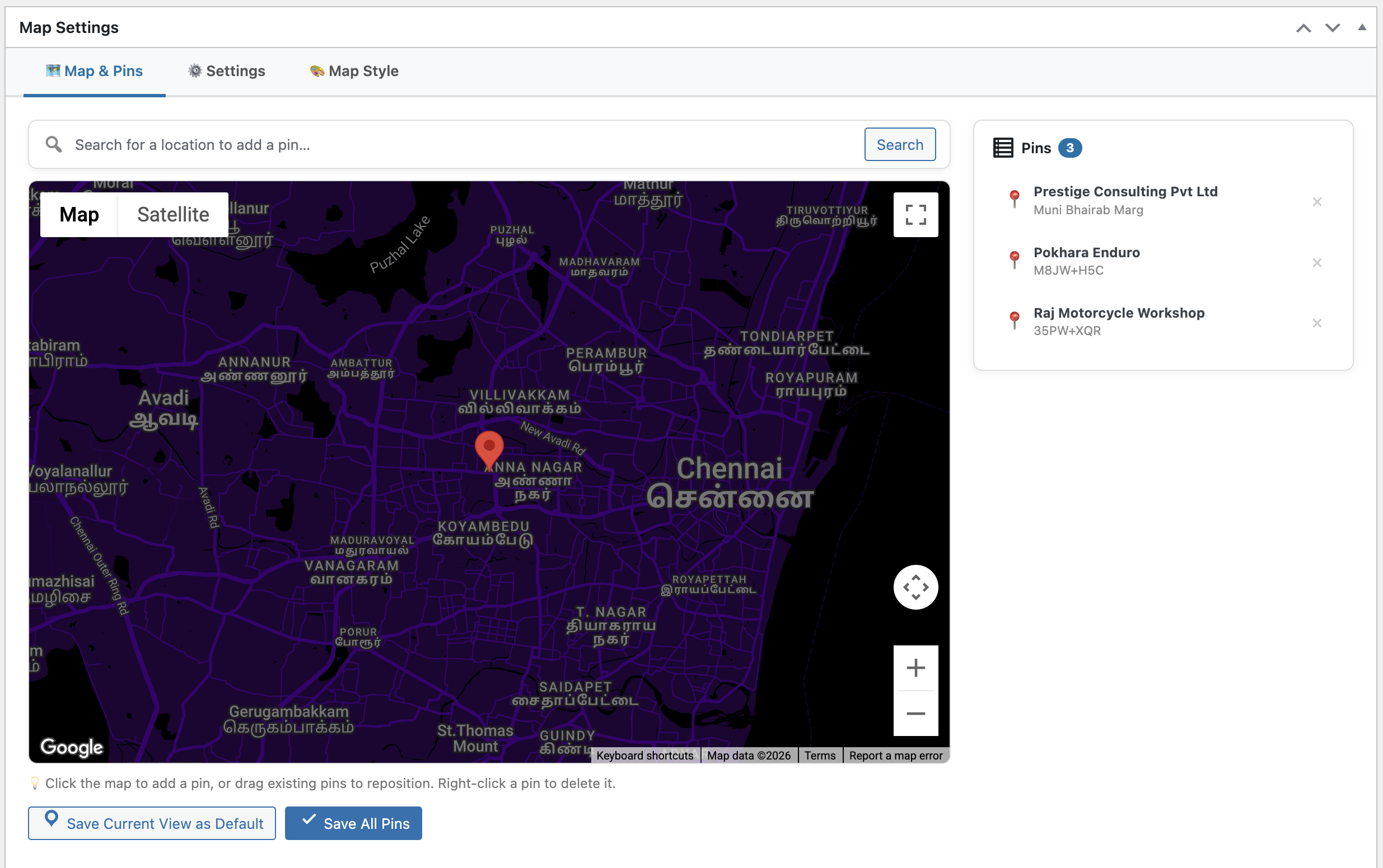
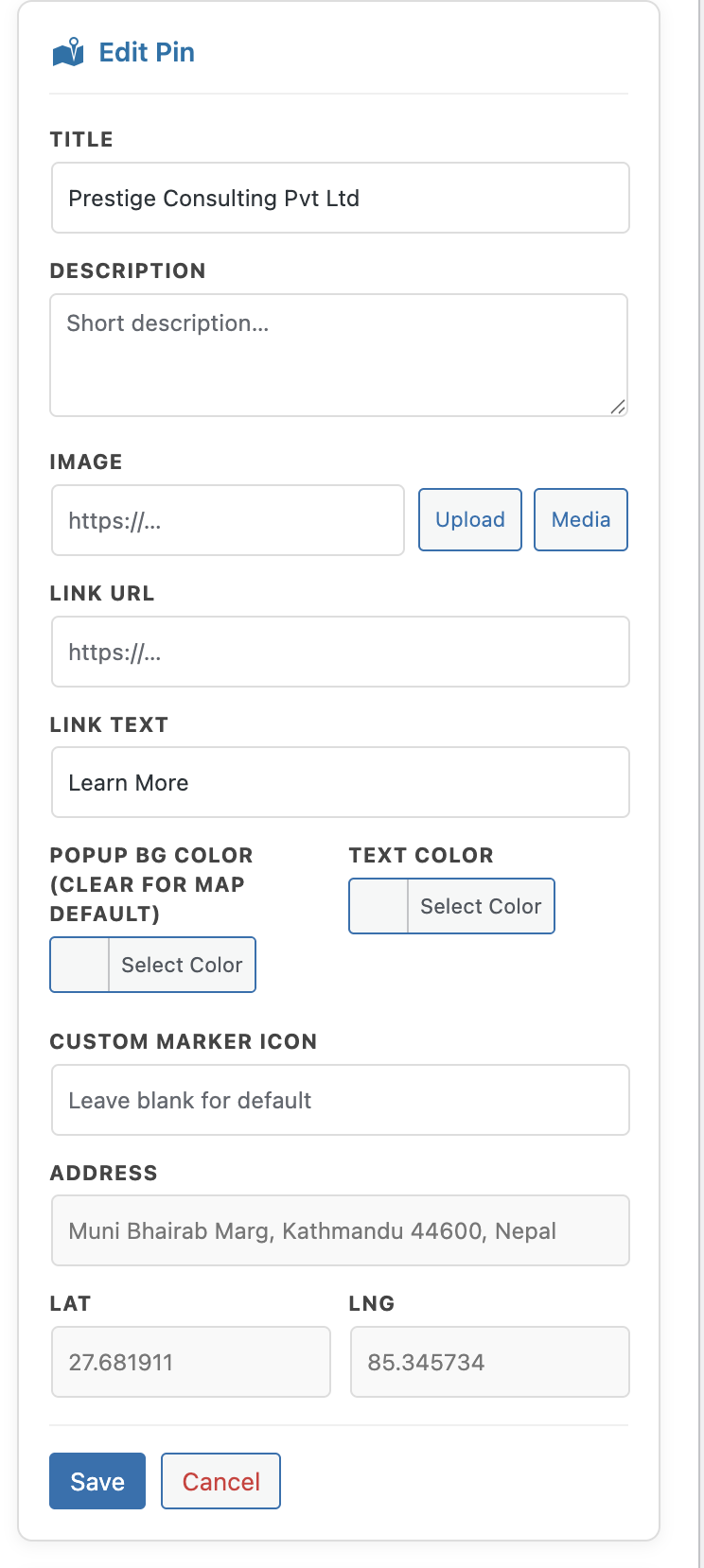
Designed for real-world use cases, the system enables users to create and manage interactive maps through a dedicated admin interface—adding locations via search or direct map interaction, and configuring map behavior, styling, and layout per instance.
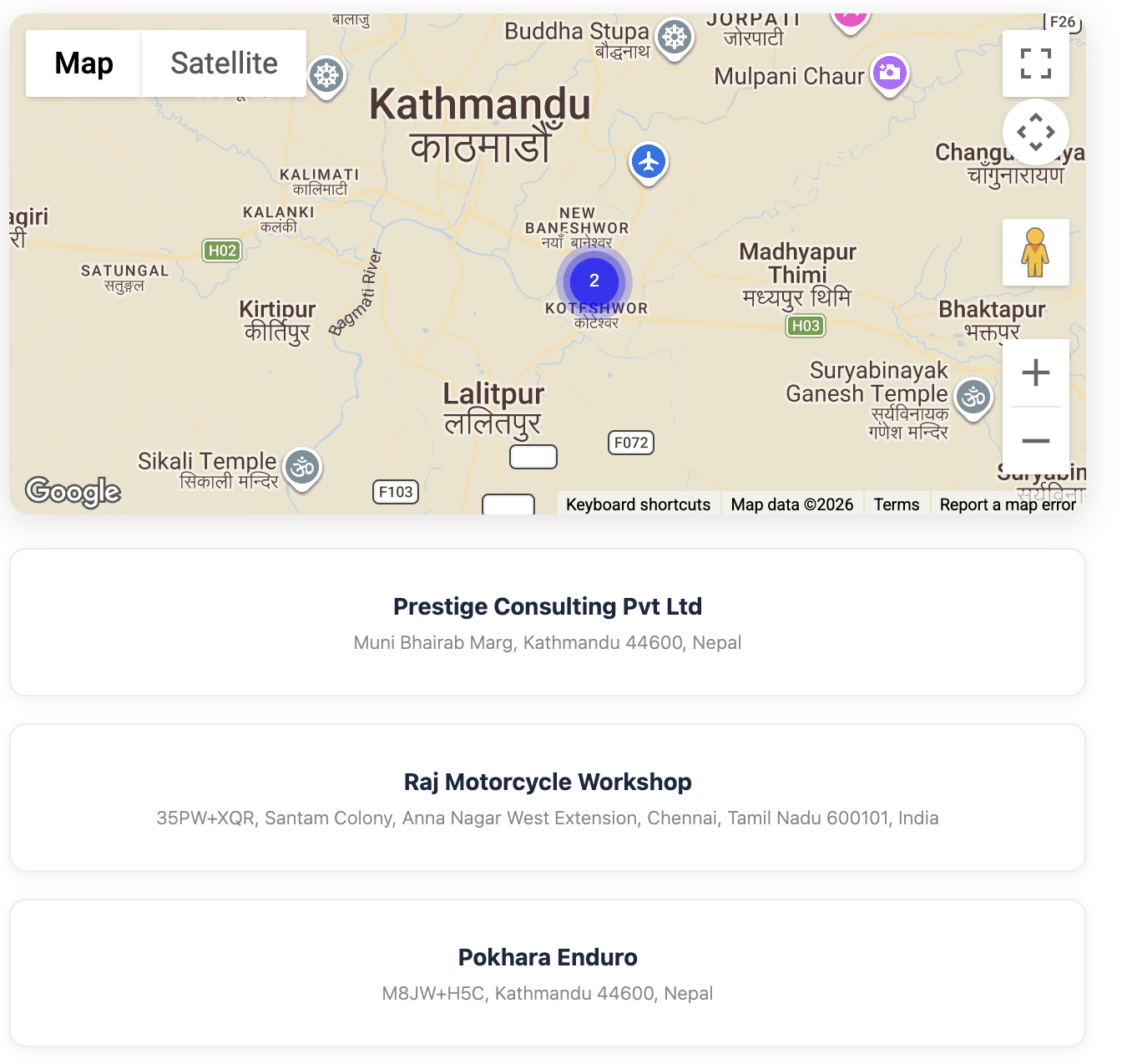
The frontend experience focuses on performance and usability, featuring marker clustering, lazy loading, and synchronized location cards that interact with the map in real time. Each map can be embedded via shortcode, making it adaptable across pages without additional configuration.
Built with scalability and maintainability in mind, the plugin avoids unnecessary dependencies while implementing clean AJAX workflows, secure data handling, and modular architecture.
Highlights
- Custom plugin development for WordPress
- Dual engine support: Google Maps + Leaflet (OpenStreetMap fallback)
- Interactive admin map editor with search and drag-and-drop pin placement
- Marker clustering and custom marker support
- Snazzy Maps styling + custom JSON themes
- Lazy loading for performance optimization
- Location cards synchronized with map interactions
- Shortcode-based embedding for flexible usage
- Secure AJAX handling with proper sanitization and capability checks
- Zero lock-in architecture with optional API usage